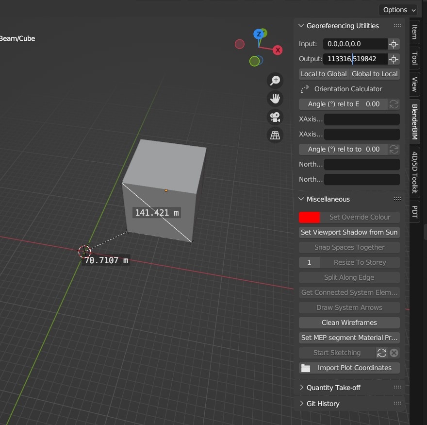
It is used to work with the geodata, not to define it. You first georeference your file and then you can use the tool to either display the global coordinates of any point in your model or to put the cursor (and for example model objects) at particular world coordinates.
Since the Blender 0,0,0 is the ifcproject origin, if you open an ifc file the cursor is placed at 0,0,0 by default and the "Local to global" will show the global coordinates of the project origin which is the same value you will find under project georeferencing.


Comments
It is used to work with the geodata, not to define it. You first georeference your file and then you can use the tool to either display the global coordinates of any point in your model or to put the cursor (and for example model objects) at particular world coordinates.
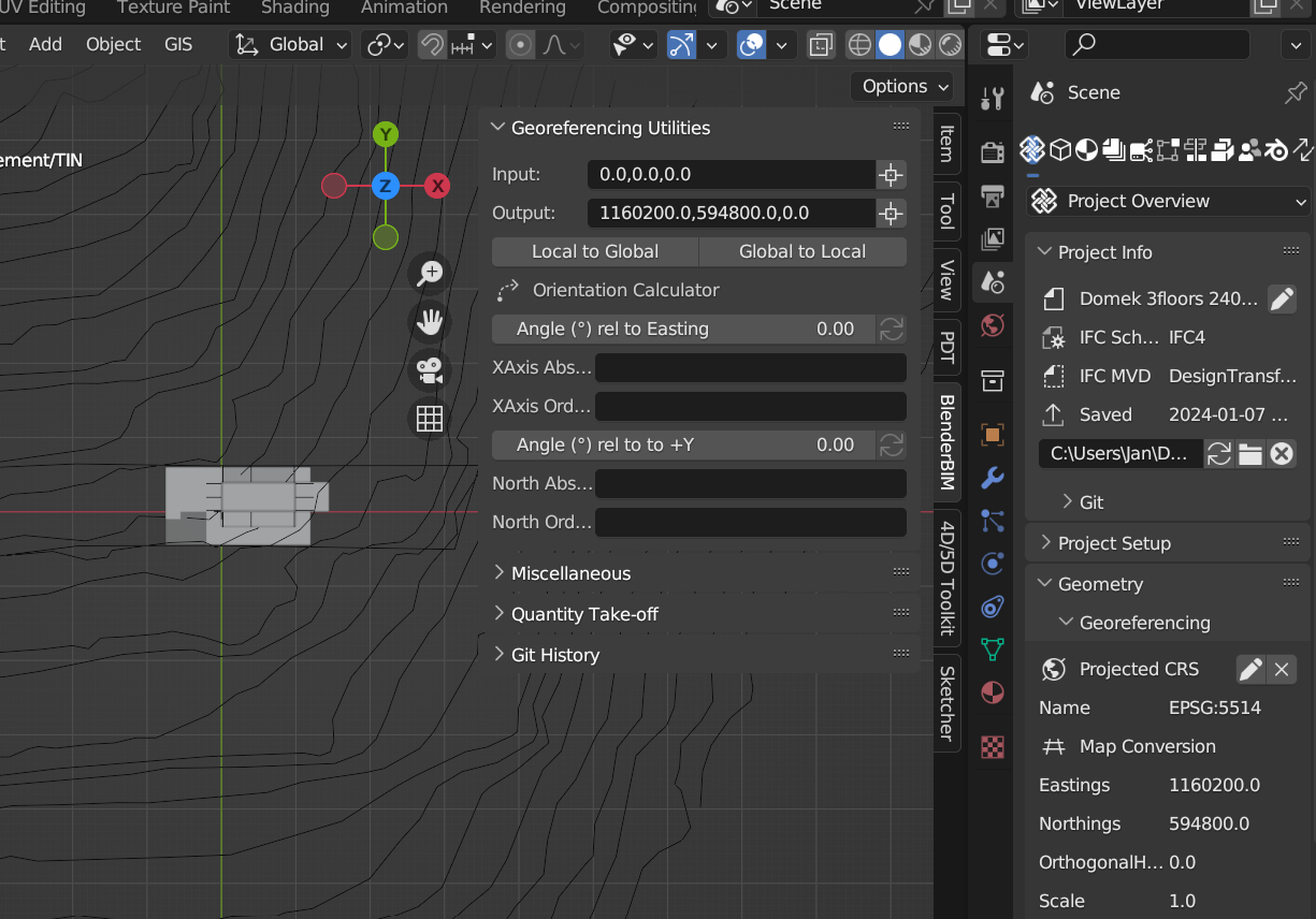
Since the Blender 0,0,0 is the ifcproject origin, if you open an ifc file the cursor is placed at 0,0,0 by default and the "Local to global" will show the global coordinates of the project origin which is the same value you will find under project georeferencing.