

Surface model, coloring
Hi guys. I'm trying to figure out this part.
Any ideas for a clearer picture? How does it work? The ultimate goal would be to make it part of the BlenderGIS addon as option.
Coming from this briljant recording on a older Blender release.
Thanks!
Hans
Comments
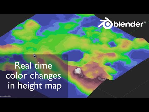
Managed to get clearer shots. So far, so good.
Added a IFC file to be tested
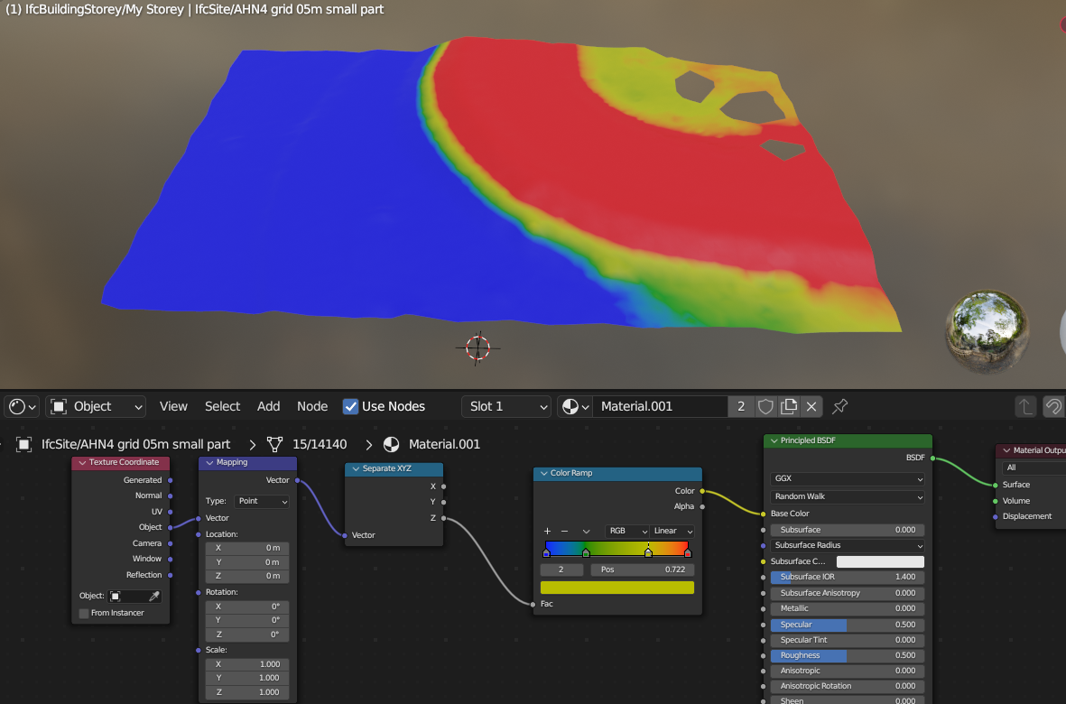
Hi...no colors are coming in. The Surface itself is being represented.
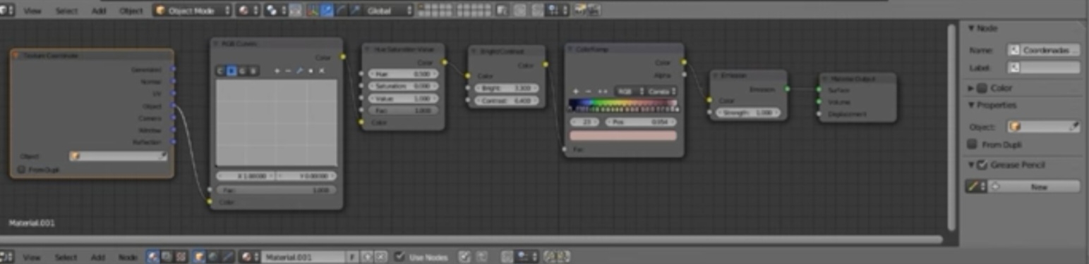
I would rather start from Generated in Texture Coordinate, plug the mapping vector in a separte XYZ node, then plug the Z value in the color ramp
Do you have a file in which this is used? I want to learn this but it's not that easy to understand what you talk about.
I attached a IFC as sample. You would need to save it as Blenderfile
I managed to get this. But shading is not what IFC colors.
The saved view tool doesn't seem to work in the shading mode with geodata far off.
How does one save shaded collored meshes to IFC?
Sorry, I didn't understand that you wanted to save it in IFC. I don't know if you can save procedural textures
My opinion is that you cannot. AFAIK
Would be nice as visual technique. ifc site in grey is hard to see the diffrences in heights. Will try dwg.
re https://community.osarch.org/discussion/441/mesh-color-to-ifc-export-in-blender and https://standards.buildingsmart.org/IFC/RELEASE/IFC4_1/FINAL/HTML/schema/ifcpresentationappearanceresource/lexical/ifcindexedcolourmap.htm You can either use vertex colors (I don't think it's implemented natively in BlenderBIM) or bake the colors to a texture map and link it as a style.
Interesting - i didn't know about textures in ifc - i'll take a closer look
AFAIK you can setup textures in IFC but the actual rendering depends on the software implementation, so YMMV.