G'day all, please read https://community.osarch.org/discussion/comment/29745/#Comment_29745 regarding a schedule to migrate forum software. Aiming to fully migrate on 15-16 Aug.
cloud2section

cloud2section is an application to automate 2D image generation from point cloud surveys.
It is a little app that I developed for my company's internal needs to draw as-built plans.
The workflow
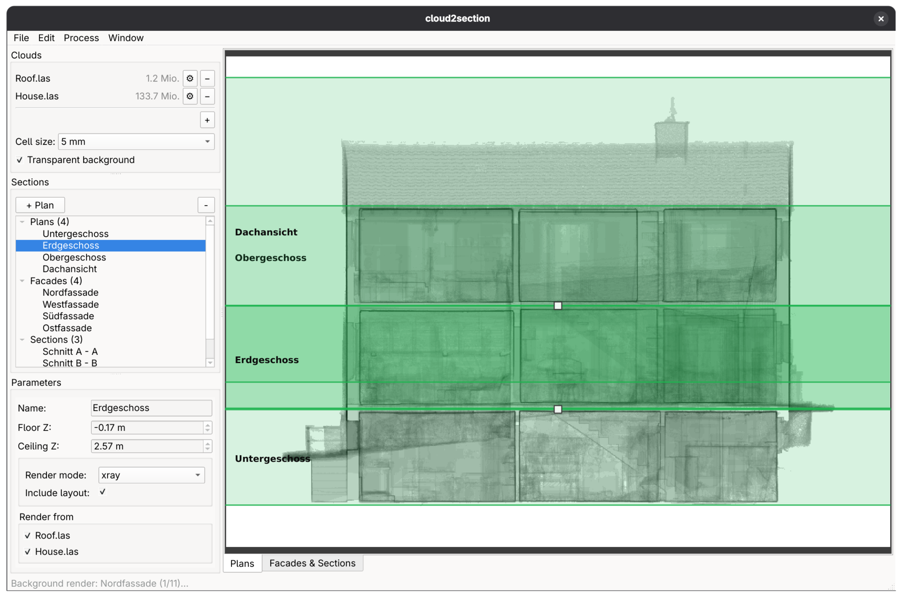
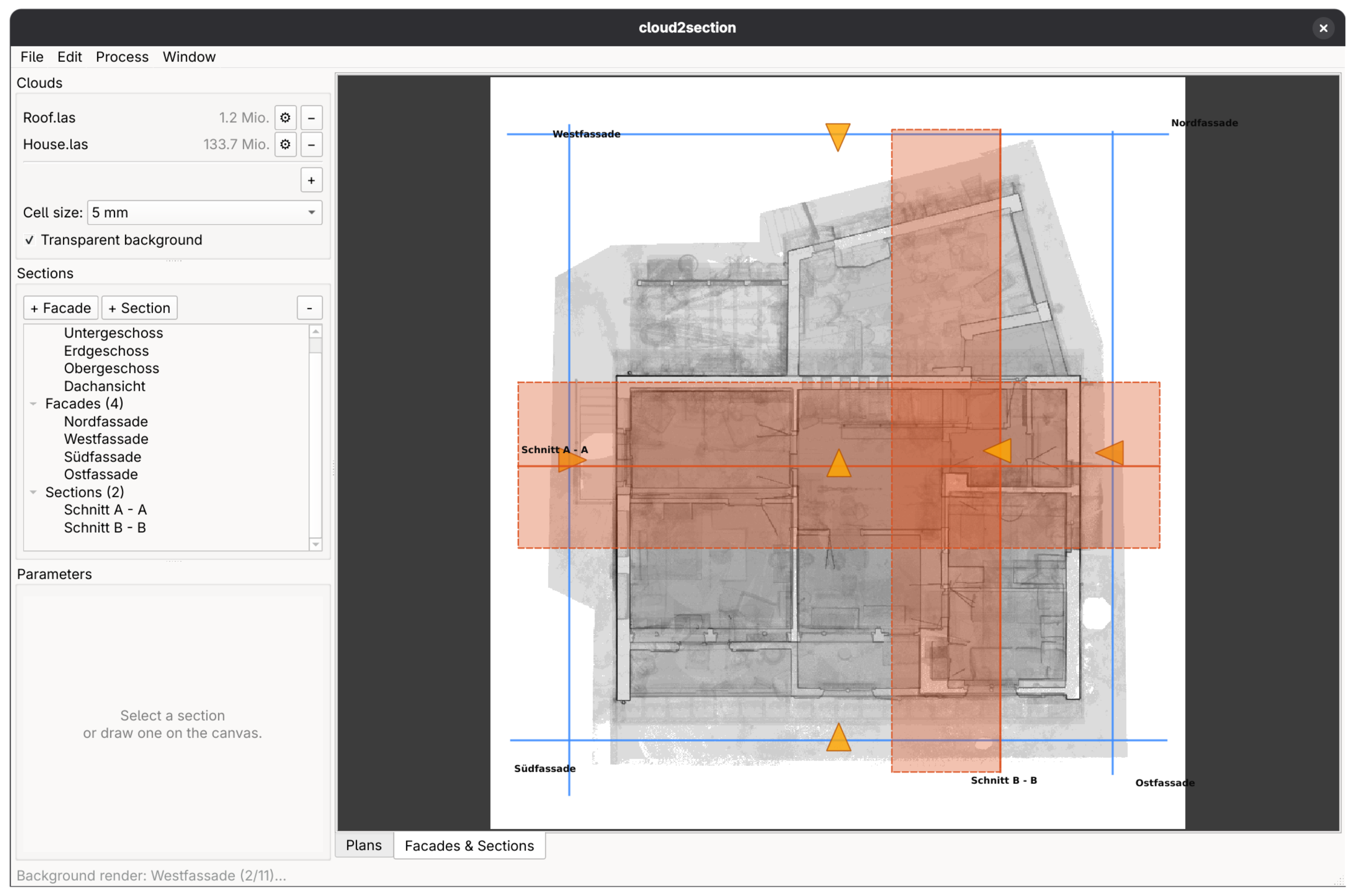
- Open your point clouds in cloud2section from LiDAR scanner, photogrammetry, etc.
- Draw the position of the section lines for floors, facades, and sections.
- Enter the project information (owner, drawing target scale, coordinates, altitude, etc.).
- The app generates a FreeCAD macro which will automatically import everything in the right place and scale in FreeCAD.
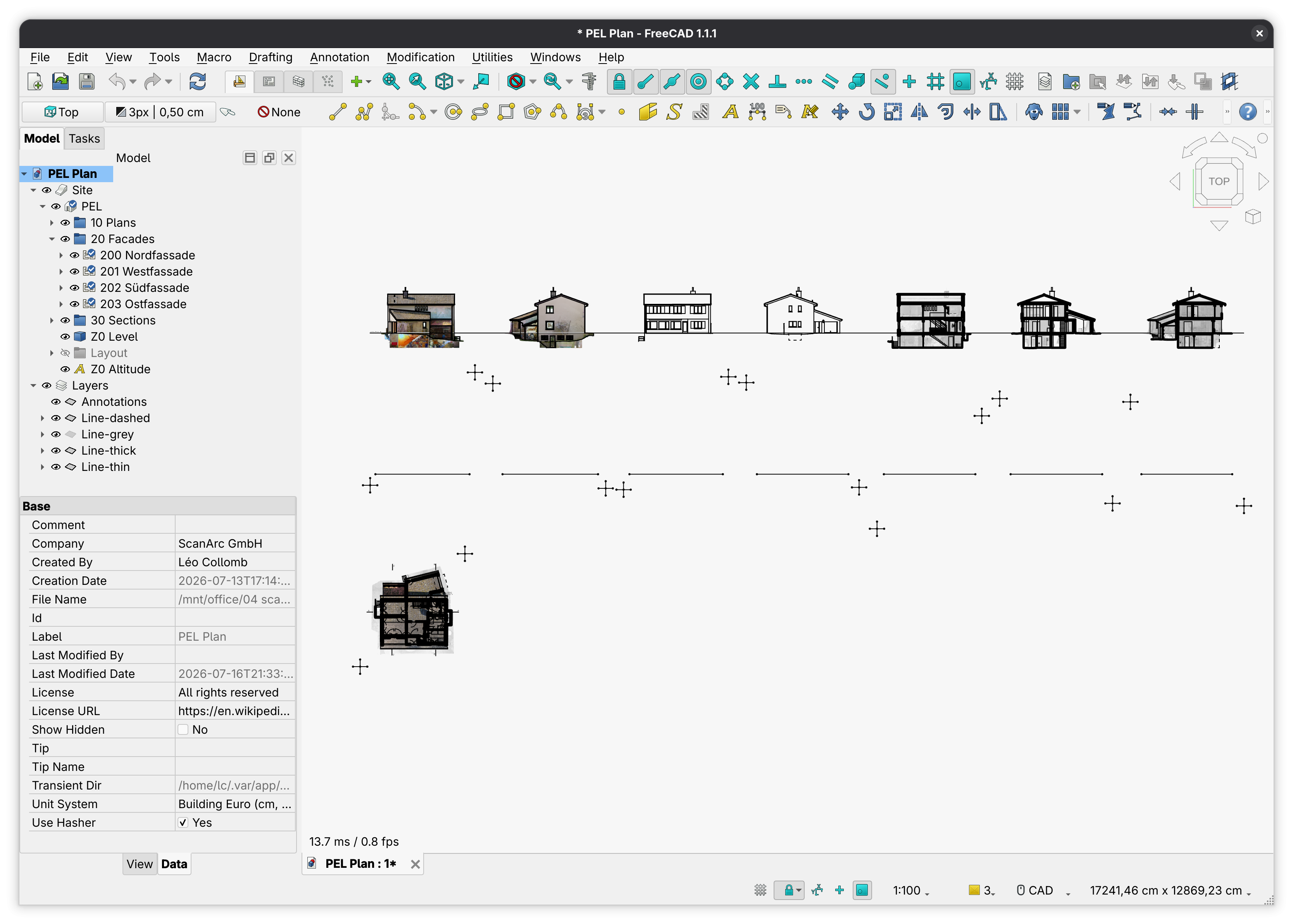
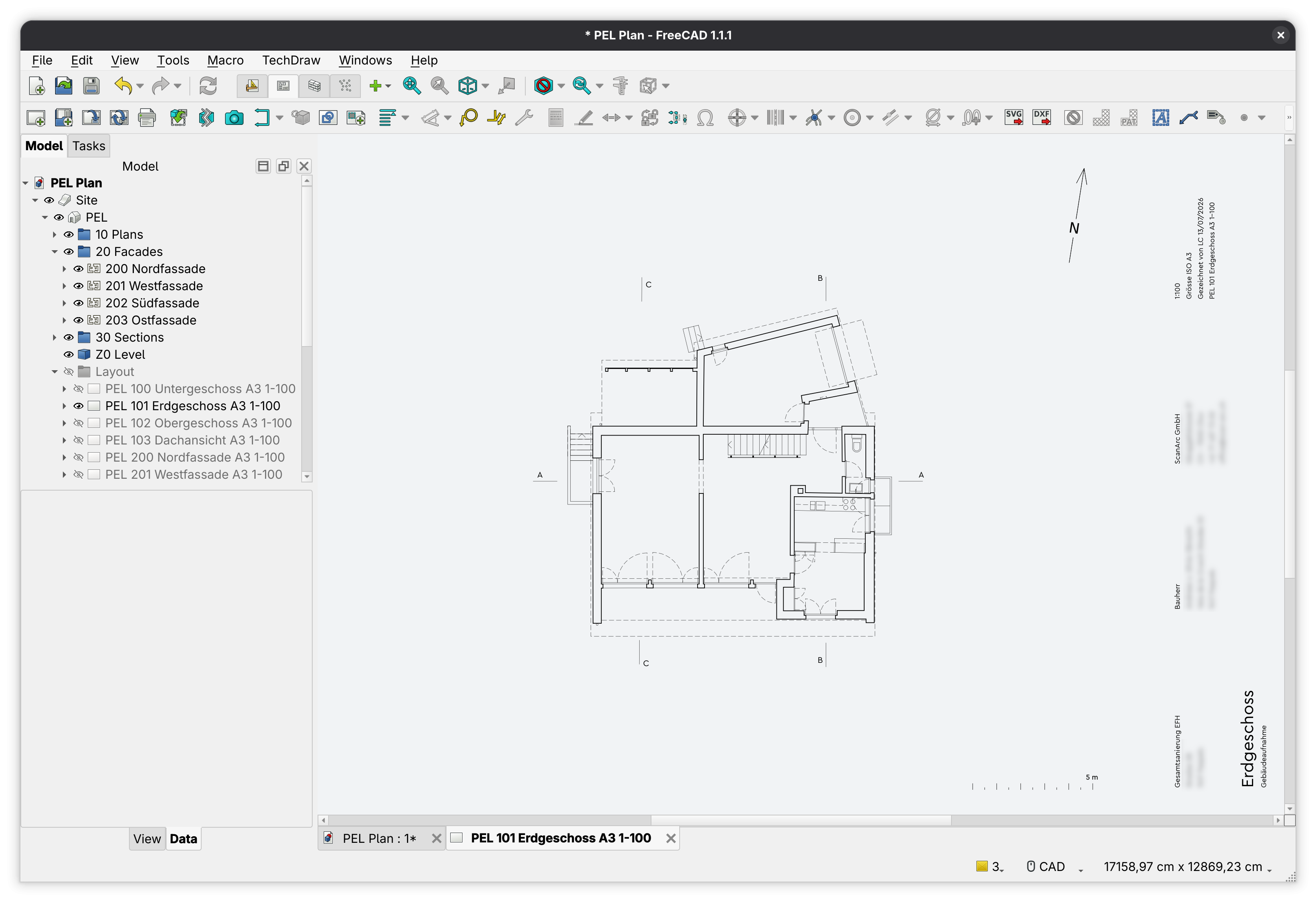
- In FreeCAD you will be able to trace on top of the generated images (x-ray or surface render). The data is pre-organized into a couple of logical BIM elements (site->building->levels) and basic layers are auto-generated.
- Every section has two datum points so they can be referenced to the floor plan.
- For each element an A3 layout page is generated with the information entered in cloud2section (north sign oriented, drawing scale, date of survey, etc.).
Extra macros that I use:
- Export all pages as one PDF (for some reason the "print all pages" feature included in FreeCAD is buggy for me).
- Export project as separate DXF (I often have errors with the built-in DXF export; this macro checks for forbidden objects and converts them, and it also makes one file per floor, section, and facade).
- Switch light/dark mode: changes the appearance of the lines and images to work with light or dark themes in FreeCAD.
If there is any interest I could make this project available on GitHub. It is completely Vibe-coded, tested only in Fedora and very specific to my needs, but maybe it could be useful to someone else.
@RaphaëlVouilloz
Tagged: