

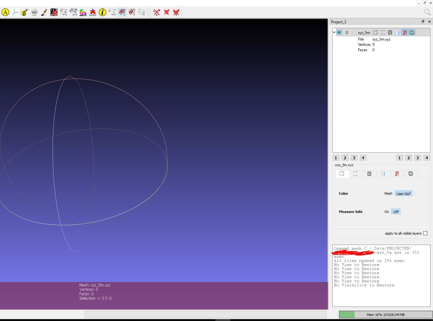
Meshlab / no view or imput xyz GIS
Hi, i need to convert a .xyz file from Qgis to .ply for import Blender import
Somehow i can't figure out how why this does not work.
Anybody have experience with this conversion?
Maybe a xyz files need another separator for this?
Thanks
Attached the 'pointcloud'
Comments
Try to export from QGis right in a format that blender understand like (.dxf / .obj) - but keep in mind that object must be at scene origin as blender can't handle georeference !
You may also export a geotiff raster as "elevation map", and import through blenderGIS.
Unless you need a non regular grid to be "meshed", the Meshlab step does not make any sense.
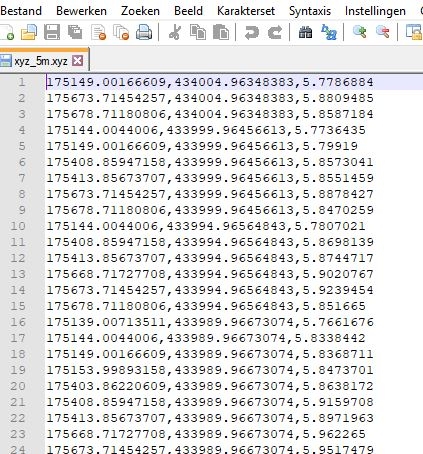
It needs to be blanco separator :) A check would be a good thing.
A geotiff extract can be converted to .xyz and .ply
I don't think Qgis is able to create any kind of mesh. Not that i know of. I don't think Qgis is the right software for it.
Need to find out how becomes visible in Blender and turn these points into a surface
Either with Blender or with Meshlab. But maybe you can elaborate how such a elavation map is created in Qgis and imported in Blender?
If your goal is to create an elevation map, you could use delaunay triangulation for creating a Triangular Irregular Network (TIN). That should do the trick for creating a mesh. You can find that in the toolbox too (just type in triangulation)! You can get either a raster or vector format as output.
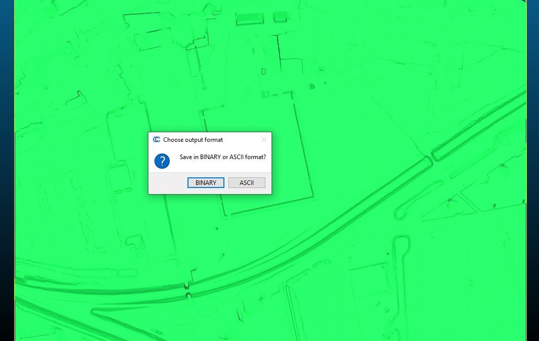
I know of CloudCompare that it can do the same thing (and CloudCompare can export to .ply). I think you can find that here: https://cloudcompare.org/doc/wiki/index.php?title=Mesh%5CDelaunay_2.5D_(XY_plane)
I never tried the same thing in Blender, so I don't know if you can do something similar there.
BlenderGIS has a tool which does delaunay triangulation.
Elevation map is a raster based way to store altitudes into pixel values of an image, blenderGIS is able to import them and recreate mesh.
Regular grid are fast to create as the triangulation is "implicit".
If the points of your "cloud" are not regular you must then use a Delaunay triangulator to actually create faces.
CloudCompare may be an alternative solution to consider for huge delaunay triangulations.
Many tools allow Delaunay triangulation, however data often suffer from over-sampling, and raw delaunay is not able to workaround - so you'll find many "degenerated" triangles.
Archipack pro terrain is able to filter such over sampled data sets by radius before triangulation and may provide a more regular / optimized mesh as result.
@magicalcloud_75 In QGIS you can use the TIN interpolation tool to create a raster DEM from points that you can then bring into Blender using BlenderGIS. https://docs.qgis.org/3.16/en/docs/user_manual/processing_algs/qgis/interpolation.html#tin-interpolation
Thanks for all the different routes. I installed CloudCompare. Importing xyz is easy, but i can not save or run the 2.5D operation (?) Is this a limitation of the free version. I think for my i have a good DTM surface with FBX. It is 95 MB so many this is beyond limits? I don't know how BlenderGIS can run delauny triangultion direct. If so, somekind of easy entry demo video would be welcome. Thanks!
nb.
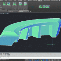
Coming from a CAD background i think FBX,DAE or DXF has some logic. I already have this in place. It needs a aerial image. But that is a other topic.
CloudCompare is open source free software, there is no other version.
Use Edit->Mesh->Delaunay (2.5d)
BlenderGIS should use now blender's constrained Delaunay (not checked if Dom implemented it, but possible) wich is faster thar painfully slow old pure python code.
Right! One should select the xyz and than the options become available. My bad.
What does Blender want here as .ply?
I gave the 'mesh' 'Delauny' a try with the geotif 5m, low res. No result yet. Files are all shared here on this place.
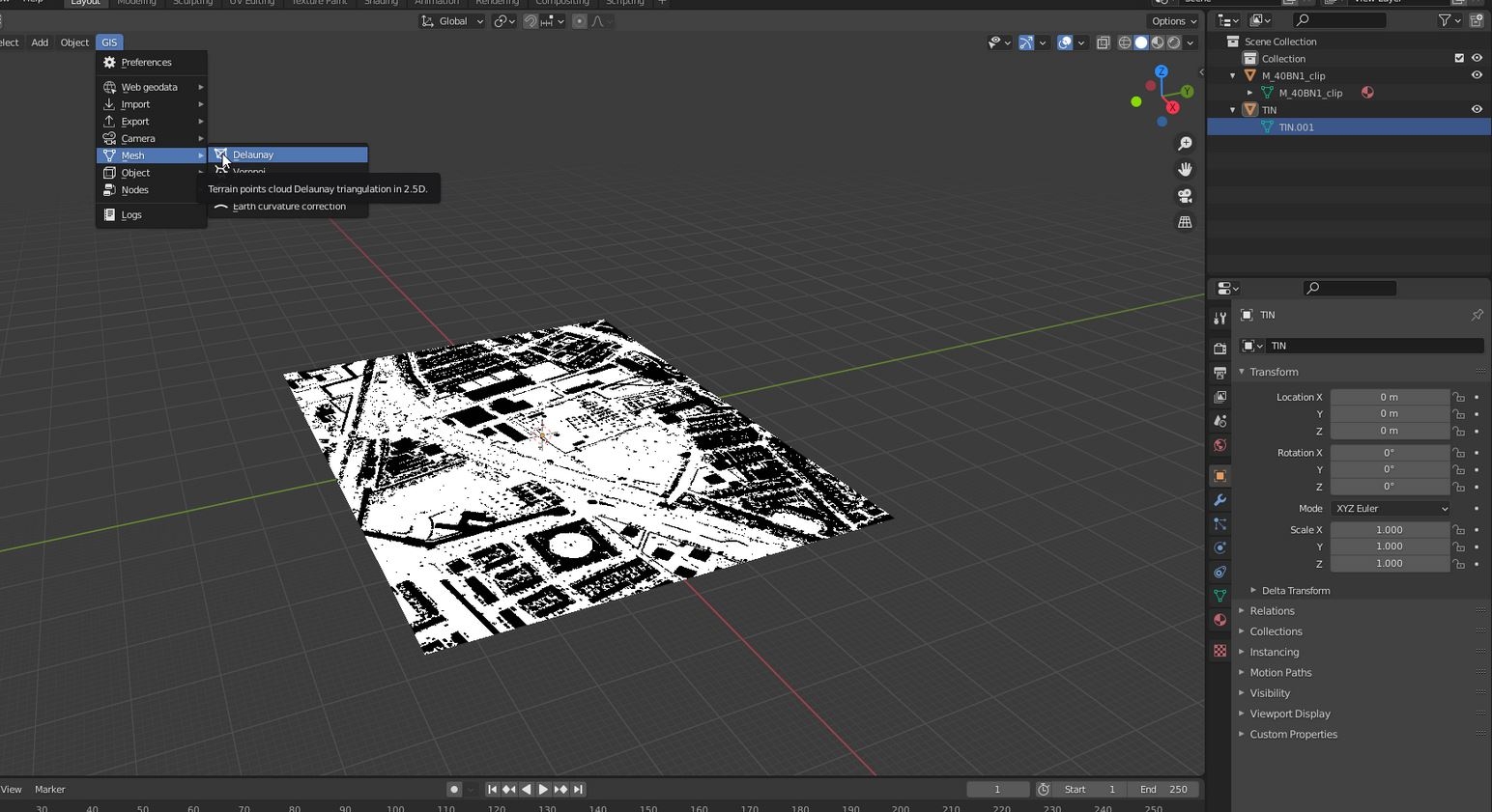
Sample file : sample TIN from Geotiff.
Thanks for any new direction or thought upfront :)
95 MB is definitely not a big point cloud size, so don't worry about that! Also, Blender supports both binary and ascii formats so that doesn't really matter. Ascii file size is bigger, but human readable (you can open it with a text reader and see the coordinates), while binary is smaller but not human readable. So whatever is your preference. I found the file size about twice as big in the ascii case. If you export, make sure you save the .mesh file and not the original point cloud of course! And that did the trick for me.