

FreeCAD Trails Workbench (Transportation and Geomatics)

Hi everyone. I'm a Geomatics Engineer and @joel_graff is a Transportation Engineer. We decide to create a workbench for our own needs. So this workbench is being developed to provide functionality specific to Transportation and Geomatics engineering.
I already did what I want at the beginning. So I decided to open this topic. If you have any idea, feature request or something else, I want to listen it and implement it to workbench.
You can fallow our progress from bellow links:
Patreon: https://www.patreon.com/HakanSeven12
Twitter: https://twitter.com/Seven12Hakan
FreeCAD Forum: https://forum.freecadweb.org/viewtopic.php?f=8&t=34371
GitHub: https://github.com/joelgraff/freecad.trails
Features:
- Geodata Tools
- Import Survey Data Files
- Export Point Groups to File
- Create Surface
- Edit Surface
- Create Regions
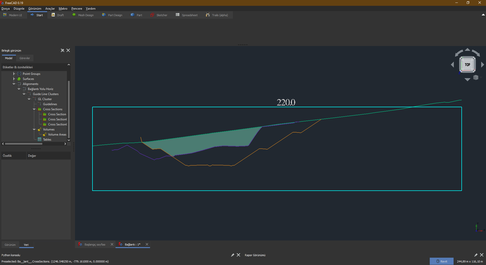
- Create Sections
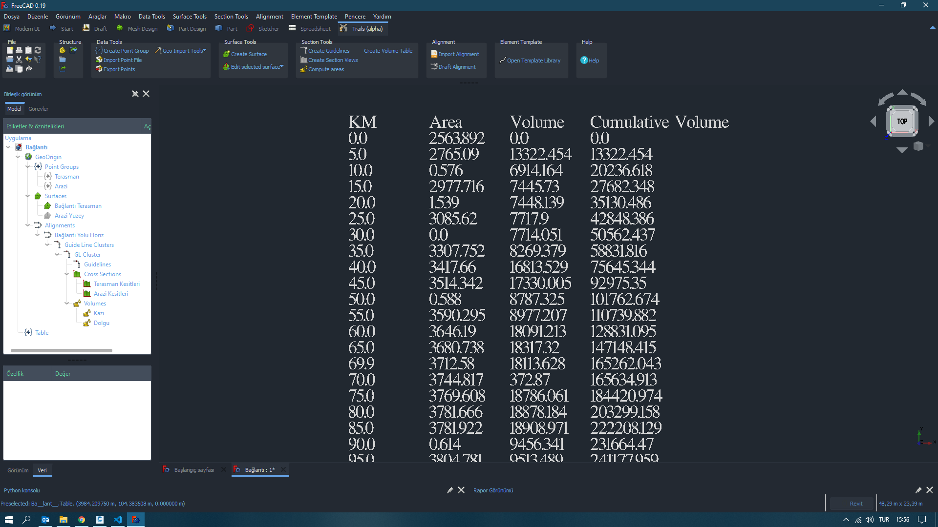
- Calculate Volume Areas
- Create Volume Tables
- Create Building Pads
- Import Alignment LandXML files.
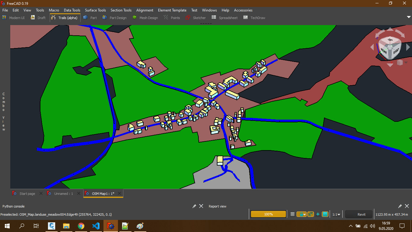
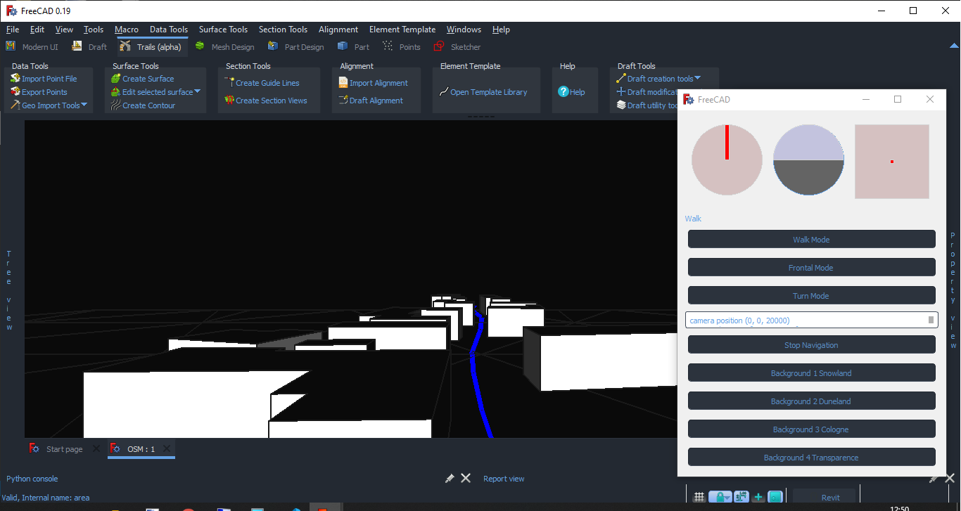
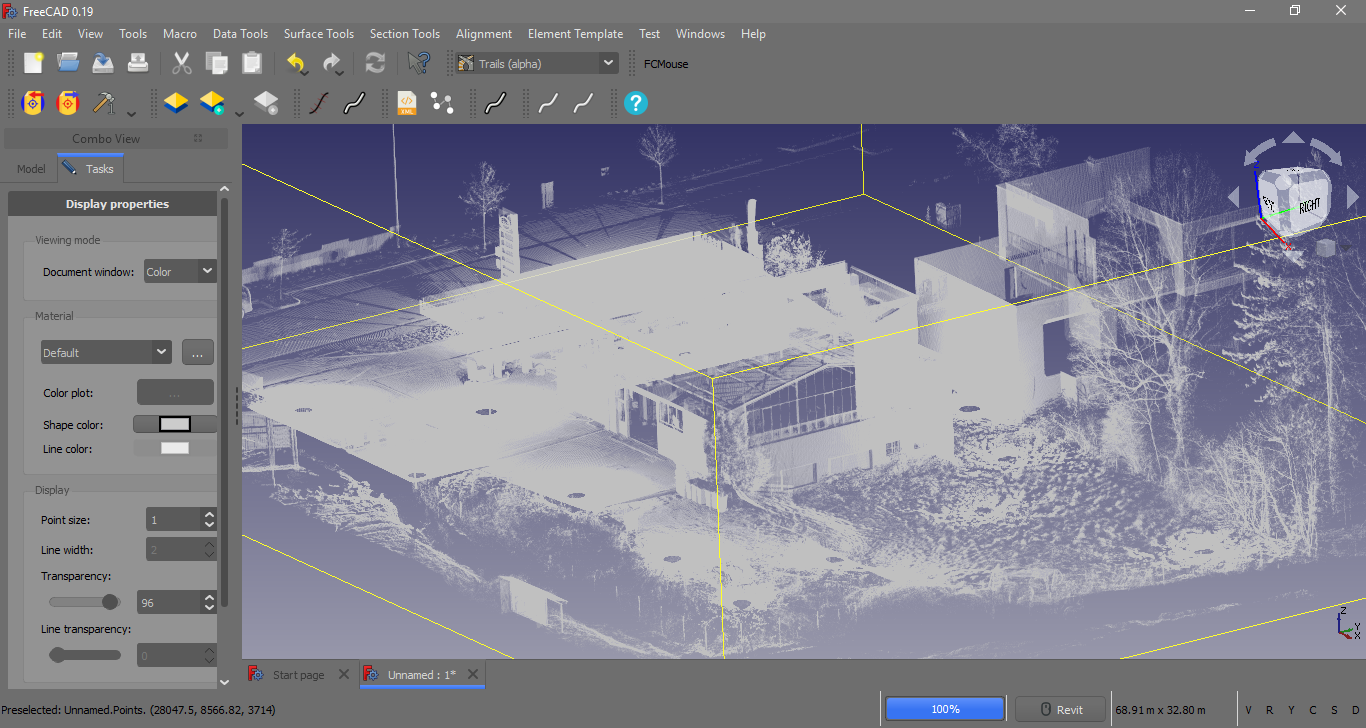
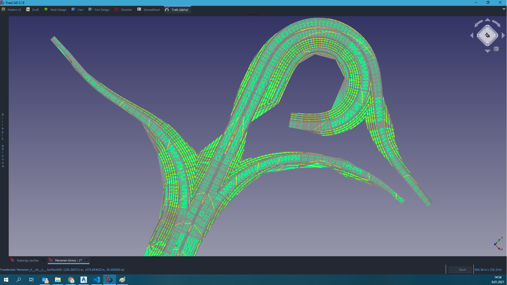
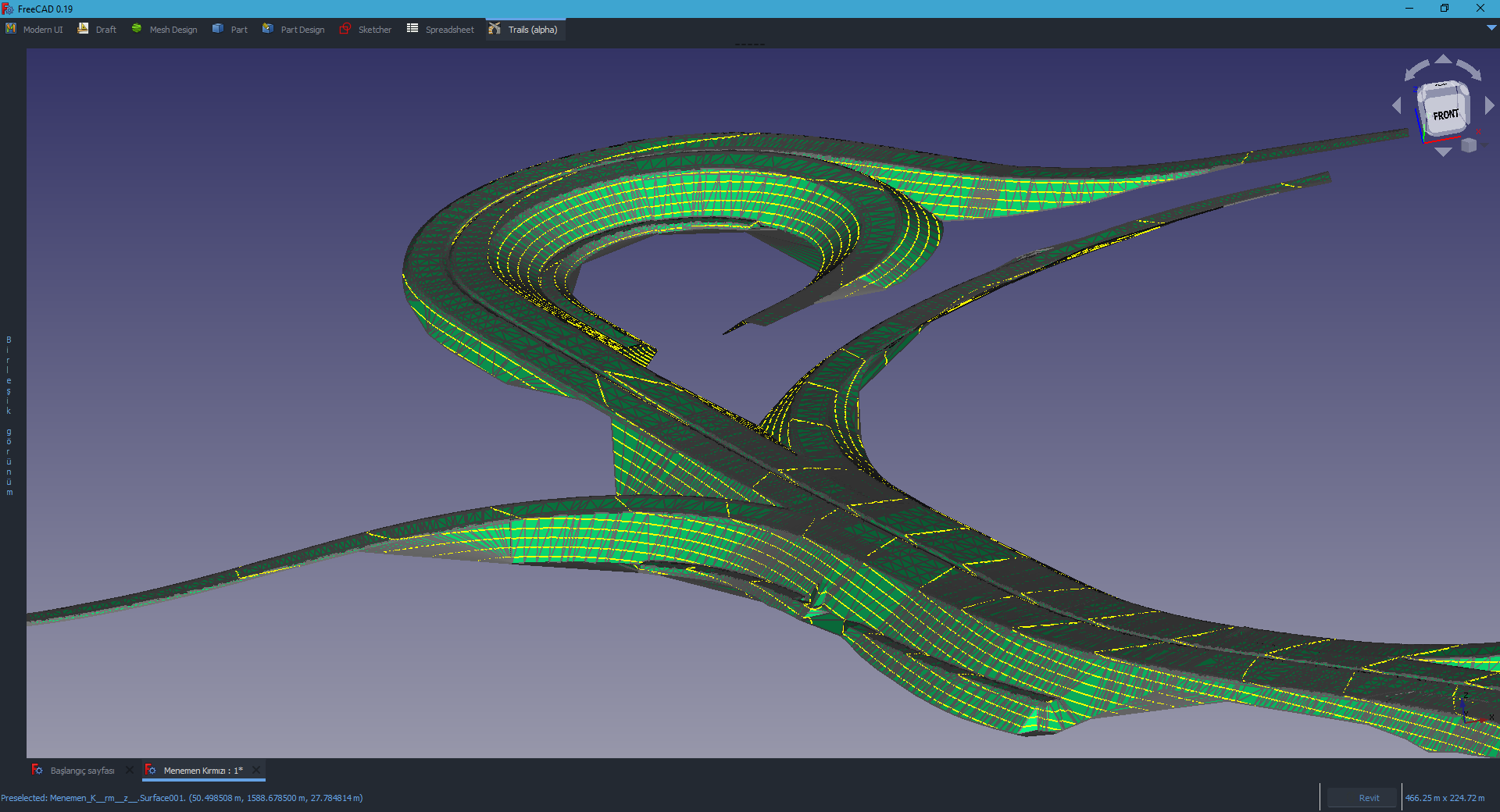
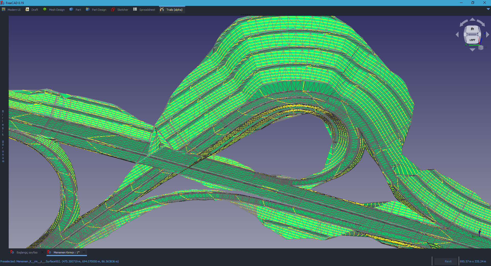
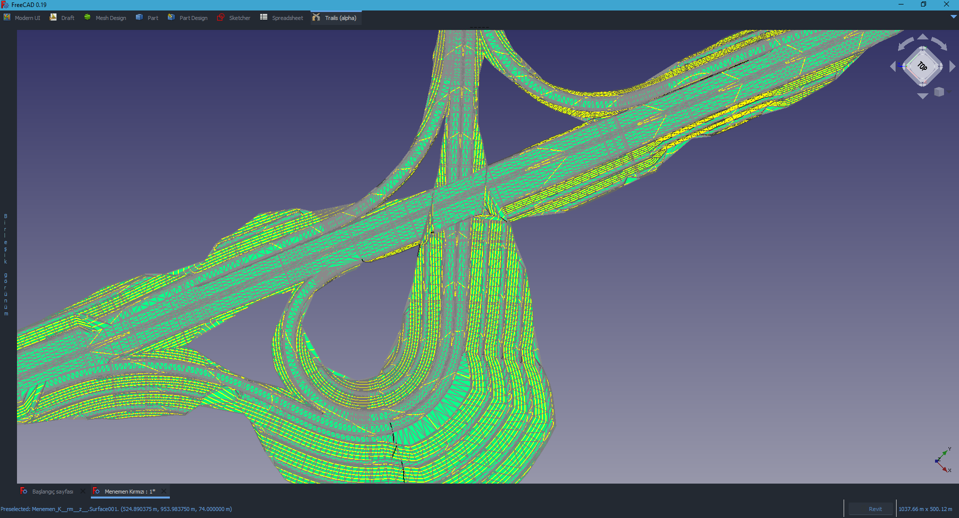
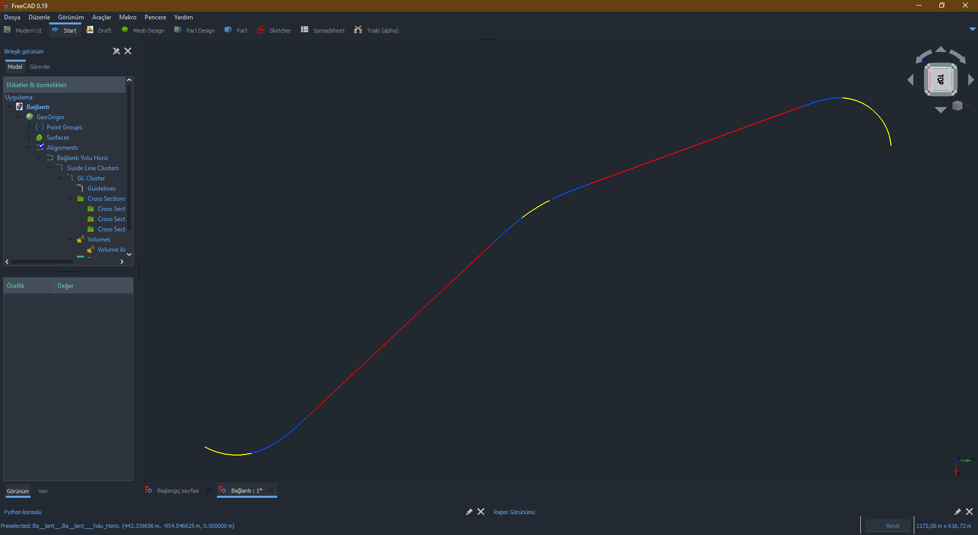
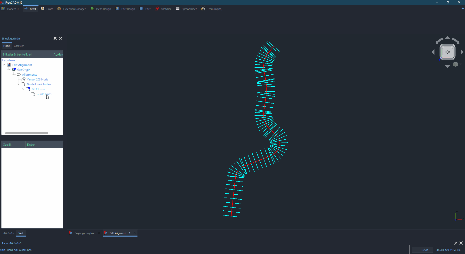
You can see what Trails can do from bellow pictures:


 and 3 others.
Comments
This is absolutely incredible. How about a presentation at one of the OSArch monthly meetups?
There was also a related post here https://forum.freecadweb.org/viewtopic.php?f=39&t=59749 - is it possible to continue this discussion here, as the topic would be not just FreeCAD related, but also perhaps affecting multiple FOSS projects?
I'd love to organise a little meeting with you and Joel and some people who have expressed interest in starting to build IFC-based infra / civil things, who can do a little show and tell - where you show and tell what's available on your side, and we show and tell what the IFC can do so far, and how we might be able to integrate! My personal background is not infra / civil / transport, so personally the only portion which affects me is swept path analysis, which I'd also like to see integrated and a little show and tell happening.
Would it be possible to organise a meetup sometime? Any preferred time and dates?
Ping @aothms - would you and the folks hacking on alignments be interested in seeing any synergies?
Also, ping @brendanmcf @brendanmcfoz , who are heavily into transport engineering, would any of this interest you or your team?
Swept path analysis is indeed one of the most important analysis in archiectural design though it would only be a very small .part .for most building type. Joel had discussed about that in FreeCAD forum if anyone is interested about some background in this aspect :)
Found a link https://forum.freecadweb.org/viewtopic.php?t=22277&start=230#p218900
Just posting here to let you know I’m around. :)
Welcome :) What about making your Turns WB is part of Trails WB?
I'm good at coding but I'm not good at make presentetion. So maybe Joel can do something for it.
About IFC support. I dont have any idea about what is IFC and how to integrate it. What are the pros?
A casual chat would be good to help share what we know from both sides :) Doesn't have to be formal presentations at all. There is a little intro to IFC on the right hand column on the OSArch wiki: https://wiki.osarch.org/index.php?title=Home_of_OSArch - here's the intro page which might help: https://wiki.osarch.org/index.php?title=Industry_Foundation_Class_(IFC)
I'm in the Sydney timezone, anytime between 8am and 8pm would be ideal :)
Very cool stuff. @Moult feel free to ping civilx64 and RickBrice on Github. They might be interested.
There is a lot of momentum around IFC. Originally coming from construction of buildings. Especially now for railway there is an active project with participants around the entire world. @yorik has been working on IFC/BIM in FreeCAD for nearly a decade now I think, so in terms of handling the file format itself, it might be pretty easy.
@HakanSeven12 - We could roll Turns into Trails. I separated it largely because it was experimental and I don't really want to add more bloat than necessary to a single workbench.
@Moult, I'm free ideally between 8 am and 1 pm your time.
@Moult, @aothms: Insofar as alignments in transportation engineering are concerned, they require specific parameters to be defined. The LandXML schema describes objects appropriate for this purpose. There is no IFC class that is really suited to defining alignments in a transportation engineering context so far as I can tell. That said, integrating LandXML support to import / export alignments from / to another engineering context isn't exactly a big deal.
@joel_graff they're working on it. IFC 4.3 is pretty imminent and will include these concepts http://ifc43-docs.standards.buildingsmart.org/IFC/RELEASE/IFC4x3/HTML/lexical/IfcAlignment.htm (unless you're referring to a type of transportation engineering I'm not aware of, it's not my field).
Implementation for these and the transitioning curves in IfcOpenShell (the open source IFC library that FreeCAD BIM workbench uses) is in progress https://github.com/IfcOpenShell/IfcOpenShell/blob/v0.6.0/src/ifcopenshell-python/ifcopenshell/transition_curve.py https://github.com/IfcOpenShell/IfcOpenShell/blob/v0.6.0/src/ifcopenshell-python/ifcopenshell/alignment.py
@joel_graff Great! What day works well for you? I'm good any day.
I've reached out to civilx64 and RickBrice who have been hacking on this in IfcOpenShell here: https://github.com/IfcOpenShell/IfcOpenShell/issues/1552
@Moult - This week, Wednesday and Friday-Sunday are best for me.
I'm interested to see if there is some synergy.
I developed a suite of bridge engineering applications (BridgeLink). The main applications in the suite are PGSuper and PGSplice used for design of precast pretensioned and post-tensioned concrete girder bridge superstructures.
I've recently been hacking IfcOpenShell to add support for IFC 4x3 RC3 and RC4 to import alignment data and export alignment and bridge data.
I'm in Pacific Time Zone (-7 UTC).
@Rick_Brice nice! Are you available Wed, Fri, Sat, Sun during 8am - 1pm Sydney time to meet up?
@moult big time difference between us. I can do Thursday July 8, 3pm PDT which should be Friday July 9 8am AEST. How do you propose we set up the logistics? Zoom, Teams, other?
How about we meet on https://meet.jit.si/openbim at that time? I can be there at 8am Friday July 9 Sydney time. Ping @joel_graff
Confirmed Thursday July 8, 3pm pdt
Will be there - ping @joel_graff can you confirm?
@HakanSeven12 @joel_graff
Just watched Video referenced on Freecad forum. Not my discipline, but looks impressive. Believe an article on osarch.org would be great
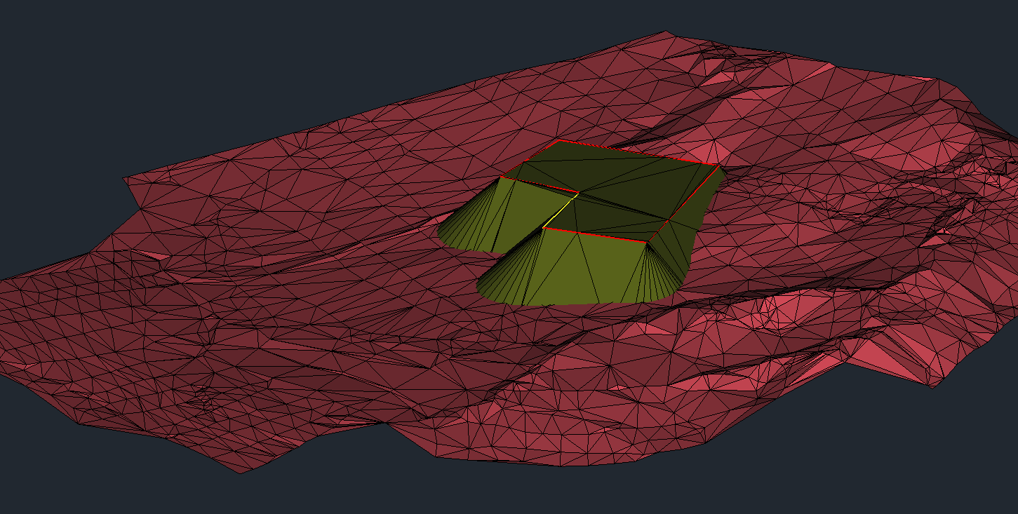
Hi everyone. Here an update. I integrated analysis for terrains. Take a look: https://www.patreon.com/posts/59366882