Mapping out a survey plan in Blender.

Curious to know of any hacks for drawing out survey plans in Blender. Always drew them out in Autocad for precision / convenience and then brought them in via dxf. Wondering how to approach it in Blender, maybe with CadTransform, or Construction lines addons.

Comments
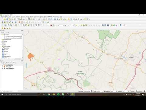
I am interested in this question as well. This probably isn't relevant to your work flow but I currently import points from our total station into QGIS and digitize the survey plan there. Then I bring it into blender using blenderGIS. I have also been eyeing and experimenting with the trails workbench in freecad as an alternative. https://github.com/HakanSeven12/Trails
For reference, here is one way of doing it in AutoCAD.
The key requirement would be a means of drawing lines at set angles using degrees and minutes with reference to due North. Geo Referencing would be a secondary feature. If CAD drawing tools like CADTransform, Construction lines and PDT could handle the first part, the second part can be handled with blenderGIS if required.
@DADA_universe I know nothing about how to draw out a survey plan, but would LibreCAD / QCAD be able to accomplish what you currently use AutoCAD for?
I haven't used LibreCAD / QCAD, but they should be able to do it being CAD tools, as long as they can draw measured lines at defined angles with precision. There is a way I used to do it in AutoCAD years ago with manual calculation of the angles and then moving and rotating the lines in place. Not very efficient but sort of worked. AutoCAD however has useful settings that make that unnecessary. It can still get a bit confusing because it is kind of counter intuitive. I think this video is better at explaining two different ways of getting it done in AutoCAD, and should be indicative of the functionalities that would be required in say CADTransform. Pinging @stephen_l .
In blender i think the closest may be construction lines addon. However dealing with coords translation / reprojections is somewhat complex and at least code base is available in blenderGIS.
There is a plugin in QGIS for laying out properties using bearing angle that I often use: https://www.northrivergeographic.com/qgis-azimuth-distance-plugin