G'day all, please read https://community.osarch.org/discussion/comment/29745/#Comment_29745 regarding a schedule to migrate forum software. Aiming to fully migrate on 15-16 Aug.
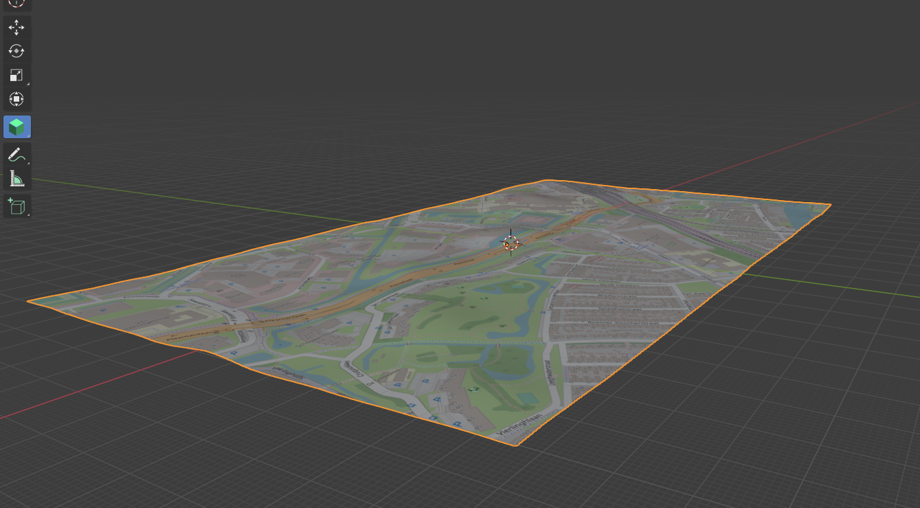
3D topo (as surfaces)
We talk a lot about 3D using and converting 3D model data.
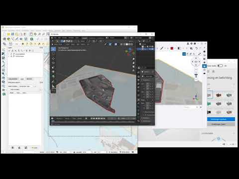
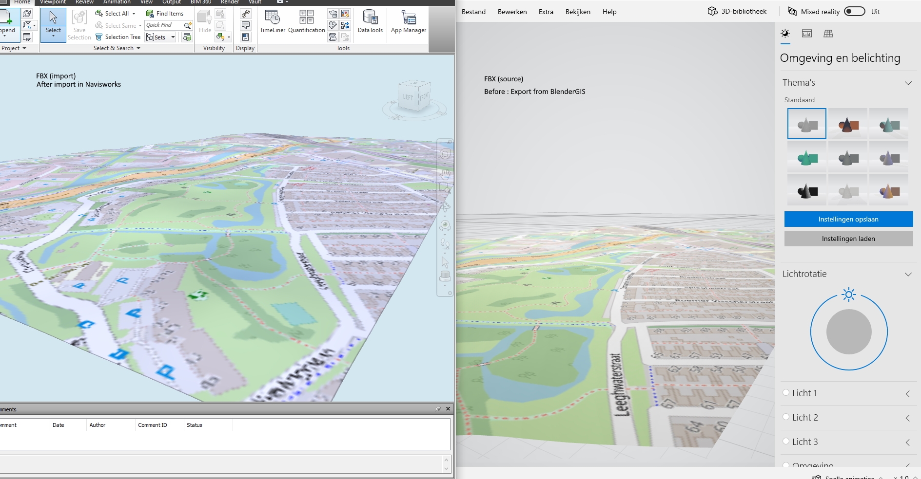
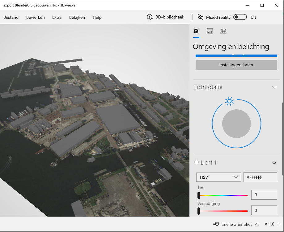
This is 2D topo coming in as FBX, in Navisworks a real disappointment. Trimble connect does not support fbx. Neither .gbl can't be used anywhere. Platform that support **both ** 3D ánd 2D have all the cards.
Does anyone of you guys have any experience in Navisworks? Why does it look like shit?
Comments
Did you check its FBX import settings? Before opening or appending the file in Navis, go to N button-> Options -> File Readers -> FBX
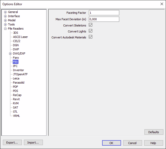
You should see something like this:
Navis refaceting geometry by default, so it can display it more responsively. Here is the official help for these settings:
https://help.autodesk.com/view/NAV/2020/ENU/?guid=GUID-5C50D5B1-4939-4500-92D9-2FEAF710CBF6
https://help.autodesk.com/view/NAV/2020/ENU/?guid=GUID-9BDA79D3-4150-4DA6-9C8B-DB452DB71D44
I guess your import is too flat, so it assumes it's a flat plane.
To see the imported FBX as-is, disable the faceting by changing the faceting factor to 0.
Thank you! I did notice these options have effect. This use of topo underlay is the general aim. It really should could be used more and supported in both web AND desktop/filebased bim. I can only think of .fbx (crs correct)
I will try some more testing with BlenderGis when i have more time..
https://demo.bimkeeper.com/extern/viewer/project/332/
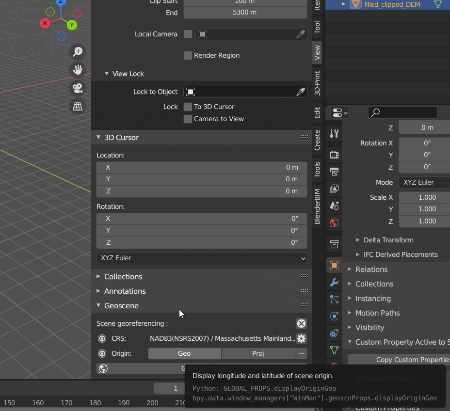
FBX files from BlenderGIS need to be know 'georeferenced'. This local point in the middle of the image is the basepoint How does one figure out the related CRS coordinat? How does it work? To make these file more useful one need to know this.
If you look in the right side pop out side bar (shortcut n) in the view section>GEOScene there is are buttons for the origin coordinates in both lat long (Geo) and the crs (Proj) of your scene.
The coordinates are tackled ! But now the scale is not yet incorrect. Anywhere in the proces this is skuwed up i think. After exporting fbx and importing it in Simulate and use a overlay reference CAD topo show the mismatch. My first thought is to use the dimension tool to get exact info about the size of the geo inserted image inside Blender. But the measurement tool seems not to allow image corner edges. How does one extract this X-value in Blender??
Also, is it possible to import/ use a boundary inside BelnderGIS to exactly fit a choosen polyline. That would also make this excercise much more easy..
Attempt without BlenderGIS, by hand
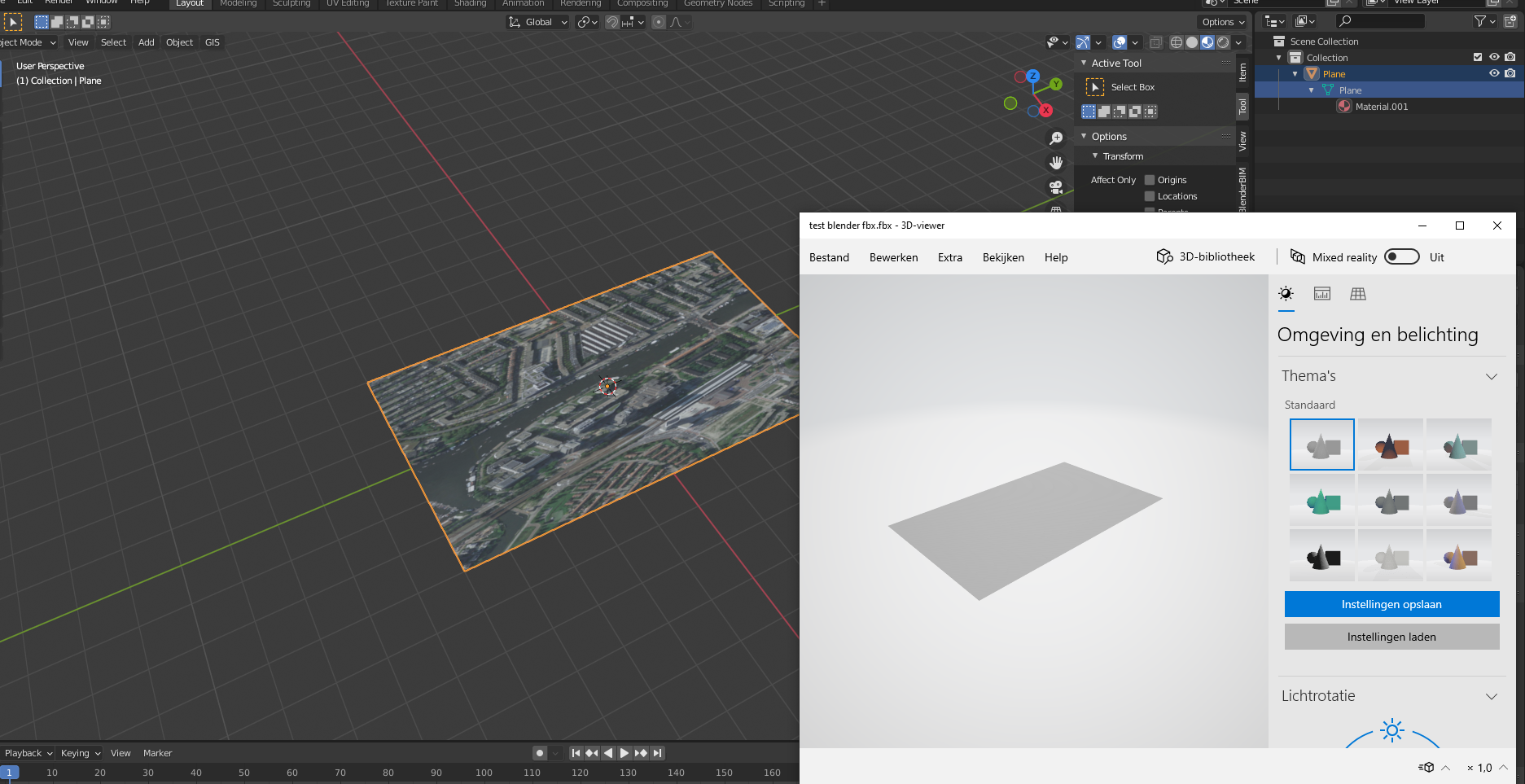
Created a mesh of 1000x500 m with the topo as material.
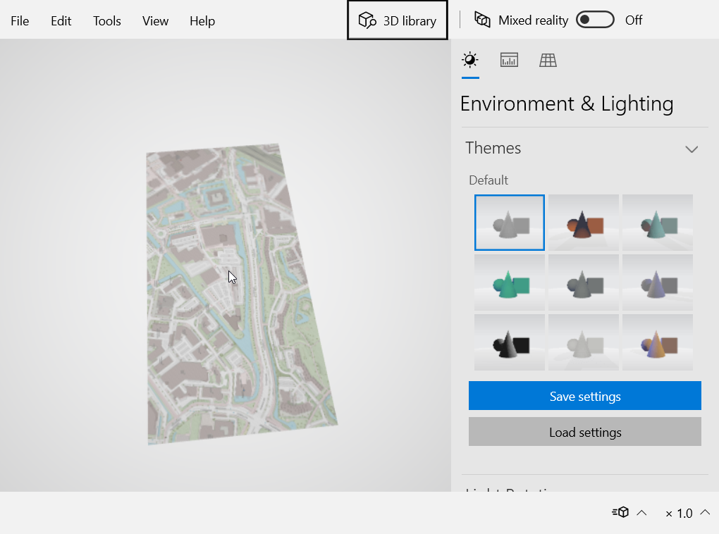
But when i export it to FBX i get an error opening it in Windows paint 3D.
Only the FBX was written but i don't see a folder with image neither.
Any settings?
Nb.
Exporting to .glb gives the result i was looking for,
But, Autodesk Navisworks does not import this, only FBX.
(Why are you using paint3d for anything?...)
Fbx can contain textures, but it's inside the fbx file, not in a separate folder.
On saving fbx usually there is an option to include textures or not, I don't know blender's fbx export capabilities.
Navisworks can read a lot of file formats, glb is not one of them: https://knowledge.autodesk.com/support/navisworks-products/troubleshooting/caas/sfdcarticles/sfdcarticles/Supported-file-formats-and-applications-for-Autodesk-Navisworks-2009-to-2012.html
What is the end goal of this thread? It seems to me you are trying to bring georeferenced, textured data from blender to Navisworks? If this is the case I recommend ifc (does it support textures?) or some gis format (I'm not familiar with gis) instead of fbx and other generic 3d formats which weren't designed for this use case.
_For testing _
Me neither. Sketchup saves the images seperate so i assumed it worked the same. As said, FBX exports form Blender fails
I know, thats why i need fbx
Yes thats right. I am trying to get topo images in Navisworks. Blender in combination with QGIS could do this fine. If i get FBX export to work. Thanks for your reply!
@magicalcloud_75 How are you bringing in your image? I am ususaly exporting an image from QGIS so it is georeferenced and bring it in with blendergis. It is therefor scaled an located correctly. If you bring it in as an image on plane. (In BlenderGIS this is called Basemap on new plane) you can measure the length of the side. If you bring it in with blendergis as a basemap on background you can not snap to the corners to measure.
I have a square of the exact project area and the image is clipped at exactly the same place in Qgis.
With left corner being 0,0 the transslation (for fbx) is a known variable.
I tried the option Geo referended image.
A .jpg and .jgw file.
Gives me back this.
Attached the file
Can this be "not a C:\ location "issue?
Thanks for commenting!
@magicalcloud_75 What CRS is your georef file in ?
@baswein Come to think of it .. :) The use of CRS:RD for NL might be what caused this error. Doooh.. :) Maybe it works with Mercator 84 from QGIS. Need to check. But still, i do like the idea of a true sized mesh with an image to a FBX. This can work with 2D drawings media as well. So i will still want to get the FBX export working...
@magicalcloud_75 I tried your file assuming it was 4326 and got the same error as you.
I then tried bringing it into QGIS and it was fine.
I then tried exporting it from qgis as a png (because that is what I usually use) with a world file and it came in with blenderGIS fine.
I then tried exporting it as a jpeg with a world file and it did not work.
I think you should try exporting it from QGIS as a PNG.
I am assuming this is a blenderGIS bug.
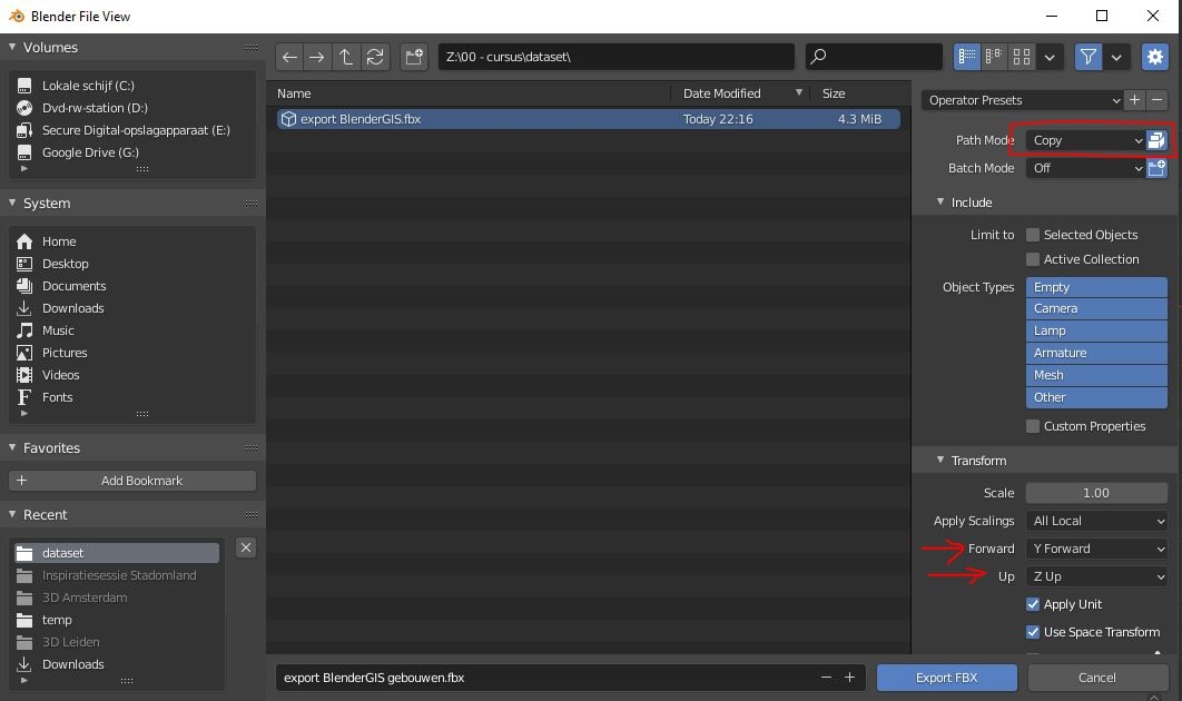
The FBX doesn't need to be georeferenced. I think i prefer to control it myself. The main problem is creating the FBX.
I tried it on a other laptop with Blender 2.93.5 but with the same result. The FBX files is without the image (stored in [\filename-map]
@magicalcloud_75 I got it to work following this video https://3dtutorials.net/blender-how-to-export-fbx-with-texture-tutorial/
Basically I needed to change the path to copy. This created a folder in the export folder with the image texture.
I also created an issue for blenderGIS about the .jepg https://github.com/domlysz/BlenderGIS/issues/568
Yes it works!
Very good. Case closed.. :)
For fun