

Models in Google Earth Pro
I work on a community project for a new part of the city. A 3d model of the area is an objective goal. To share fotos stories drawings as a live bimgis environment.
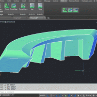
Because it needs to be 3d i want to use Google Earth pro. But this programm does not eat IFC or 3d Gis models, only kml. The excisting buildings are available as cityjson and i can turn them into ifc amd gml. But it looks like he exporter of FZKviewer gives incorrect kml exports.
My question is: what other programms and routes might be worth exploring to turn cityjson into kml 3d! files. Is Blender capable of export kml? Importing gml of direct json?
Anything one of you smart coders can think of is welcome
Regards hans
Www.zijdekwartierarnhem.nl
Comments
Basically kml is a subset of collada format.
Blender is able to import kml, see https://github.com/skrat/bpycollada
i'm not aware of any kml export ability.
There are quite a few ways to bring in google earth imagery and dtm models in various applications. But i am trying to move it the other way. Seems like nowadays trimble sketchup even can't make kml files geolocated properly. Not there yet. Kml exports from OpenSource initiative would be a blessing.
I have a feeling the 3D model link between Sketchup and Google is nog so strong. I used to be better.
Not even Sketchup 2021 can make IFC import a nice this kmz kml display.
Anybody?
Have you Tried Blender GIS?
It uses OSM data and then you can export to a dae file which can be imported into Google Earth?
Blender GIS:
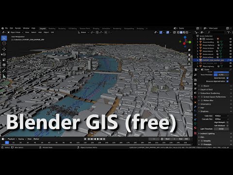
Not certain of a direct way to export KML files from Blender atm
Yea. I have tried some :) i don't think exporting kml kmz is an option. Are these files considered open standards for gis data? I find little support. This is the latest is strange things. I feed google with sketchup kml exports.
how about this here ?
My question is merely a general one.
About the status and support of .kml files in the land of Free and Open standards.
I think kml would be very handy in Google world.
https://en.wikipedia.org/wiki/Keyhole_Markup_Language
"Keyhole Markup Language (KML) is an XML notation for expressing geographic annotation and visualization within two-dimensional maps and three-dimensional Earth browsers. KML was developed for use with Google Earth, which was originally named Keyhole Earth Viewer. It was created by Keyhole, Inc, which was acquired by Google in 2004. KML became an international standard of the Open Geospatial ****Consortium in 2008.[1][2] Google Earth was the first program able to view and graphically edit KML files, but other projects such as Marble have added KML support.[3]
Made it in Trimble now. Works better, but can't be shared without paying.
By the way, a KML file is basically a Collada export with a little XML file zipped up - you can manually create one quite easily. Here's a guide that I've followed successfully in the past - getting an IFC into Blender, exporting into DAE, then copy pasting from this XML template and changing the geolocation parameters: https://developers.google.com/kml/documentation/models