

[BlenderBIM] Tiny cabin starter project

Hello all. I just joined the forum. I am a total newbie to BIM. I have an idea for a project perhaps can introduce me both to construction and BlenderBIM (if that is the best software choice here). I would like to get some suggestions from the experienced pros here.
My plan is to build a tiny 120 square feet cabin. The reason for 120 sq ft is that buildings with a gross floor area of 120 square feet or less do not require a building permit from the local government. This should significantly simply things and reduce the cost for me. A smaller, simpler building will also make a good first project to learn from. Although, not needing a permit doesn't mean shoddy construction.
My thought is that if I use something like BlenderBIM, it will let me design the cabin, which will let me see how different designs will look, and also I could get input from experienced architects if something about the design doesn't make sense, or is not sound engineering wise. It hopefully will also allow me to cost out the design relatively accurately.
Do you think I am on the right track here? Or is this too ambitious and doomed to fail? All comments and suggestions are welcome.


Comments
Would love to see what you already came up with.
@koensayr this sounds like a doable project, and I would hope that this is a place where you can get good advice about the construction aspects as well as the software - osarch is about open source architecture as well as open source software
Sounds cool, I've been looking for someone with a real project we could use as an example. I can help you, if you in exchange promise to write some paragraphs about your workflow to iur wiki ? (there's an empty link waiting for that: https://wiki.osarch.org/index.php?title=A_simple_step_by_step_example_of_a_project_with_BlenderBIM_Add-on&action=edit&redlink=1)
There's been some discussion about this for example here:
https://community.osarch.org/discussion/531/discussion-on-freecad-blender-sketchup-workflows#latest
Thanks everyone for the comments.
@Coen I don't have anything to show yet, but I'll be sure to post up things when I have something to show.
@brunopostle Thank you. And I hope I'll be able to find the help here.
@JanF That's sounds like a great idea! I'm definitely willing to write up my experience as I go through the project. I also think that will be very helpful for others that are thinking about starting a project as a new user to BlenderBIM. How do you think I should approach this? Do I just start writing down what I'm doing as I go, and perhaps edit it later down the line?
I would suggest we keep the discussion here and when you finish one stage, you add a paragraph or two to the wiki page describing the workflow you think works.
For starters I have the following suggestions based on the research I have done so far:
We'll try to stay with Blender only.
1. We'll use gitlab as a CDE. Create a public repo, get all the base data you can (be careful not to break any licences) create Blender files for your base data and georefeference them correctly. Push all the base blender files to the repo.
2. Create your main project file, set up an IFC project with Blender BIM link in all your base data and push it.
3. Your project is rather small, so we don't probably need to separate the project library. You can define all your materials and types in your main file.
4. Model your house using the types you defined
5. To be continued..
Here a tiny house project made with FreeCAD

I already have a GitHub account. I do not have a Gitlab account, but I guess it should be easy to create one. Is there a preference for one over the other?
As for base data, since you mentioned geo-referencing, are you referring to something like elevation map of the site? What are the base data?
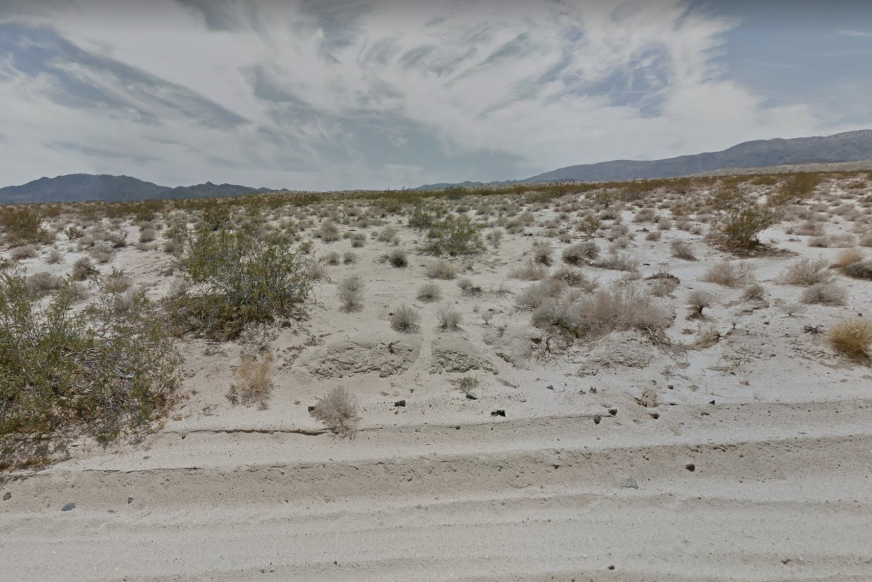
I prefer not to give the exact location of my site. However, it is located in the high deserts of southern California in the US. So site quite flat, there is minimal precipitation. And temperature rarely drops below freezing. I think the coarse map of frost line places the frost line here at 5 inches. This is outside Joshua Tree National Park.
Thanks. It's always interesting to see what others have done in terms of design.
Gitlab is open source and you can self host it to have complete control over your files. But 8f it's easier for you, you can stick with GitHub, I do it as well for now.
Yes exactly, I mean all the maps and plans you'll use as a base for your design decisions - I generally start with the 2d building groud borders, 3d terrain and 3d neighborhood model gor example.
Ok understand. I find it important to have all the stuff georeferenced correctly, because I tend to work with many interlinked models. Can you by any chance for example move your coordinate system by a fix value, so that the north stays correct, but only you know the exact location?
I have created a gitlab account and create a project: https://gitlab.com/osarch1/tinycabin
I installed BlenderBIM and BlenderGIS. I changed the units to Imperial and created a BlenderBIM project. With BlenderGIS, I used a location that is nearby (it's going to look pretty much the same as you will see). I downloaded satellite image and 30m DEM data following BlenderGIS instructions.
However, you will see that since this is out in the middle of nowhere, the desert is flat, and there are no buildings nearby. So I'm not sure how these base layers will be of any help. If one wanted to include the mountains into the background scenery, it will require a lot of DEM data as the mountains are quite far away.
Any comments on what's the best approach in terms of base data here?
I can't see your project under the link, is it public?
Well if there's nothing around, there's not much use in importing the data :) But I suppose you have at least property lines? Trees maybe? This is not really relevant to modellig, it's jut that houses are usually designed to stand somewhere, so I like to have as much information about the surroundings as possible in my model.
Anyway, if your're done collecting and sorting your base data, you can set up your levels and import or define your types - your basic materials, wall, slab, roof, window and door types should do for now I guess.
Oops, I forgot to set the project to public. It should be public now.
Here is a picture of what the area looks like. It's desert and shrubs.
I see beautiful
How is it going? Do you need any help?
Thank you for checking in. I've been busy with family stuff and I've also been sick for the past week, so have not had much chance to work on the project.